Tailoring innovation to customer’s specific task or business process has always been a second nature to our team. When cutting-edge technologies are integrated into any business process, many questions arise. Addressing them, we sometimes even dispel myths about some solutions and their functionality during a demo. Today, we will give answers to the most frequently asked questions about a drone-based & AI inventory solution for warehouse inventory by UVL Robotics.

Kirill Bondarenko | Technology Expert
Book consultation
Technology is like a set of versatile tools. Any problem can be solved with it, if you know how it all works at a fundamental level. In fact, innovation derives from a few pieces of technology successfully combined, thus creating a new product to get a particular job done effectively. The idea of a sci-fi future inhabited with smart robots and flying cars in a Blade Runner esthetics is a certain inspiration for us, like for all others. This is fantastic, but the primary goal of technology is to solve relevant problems using twenty-first-century tools.
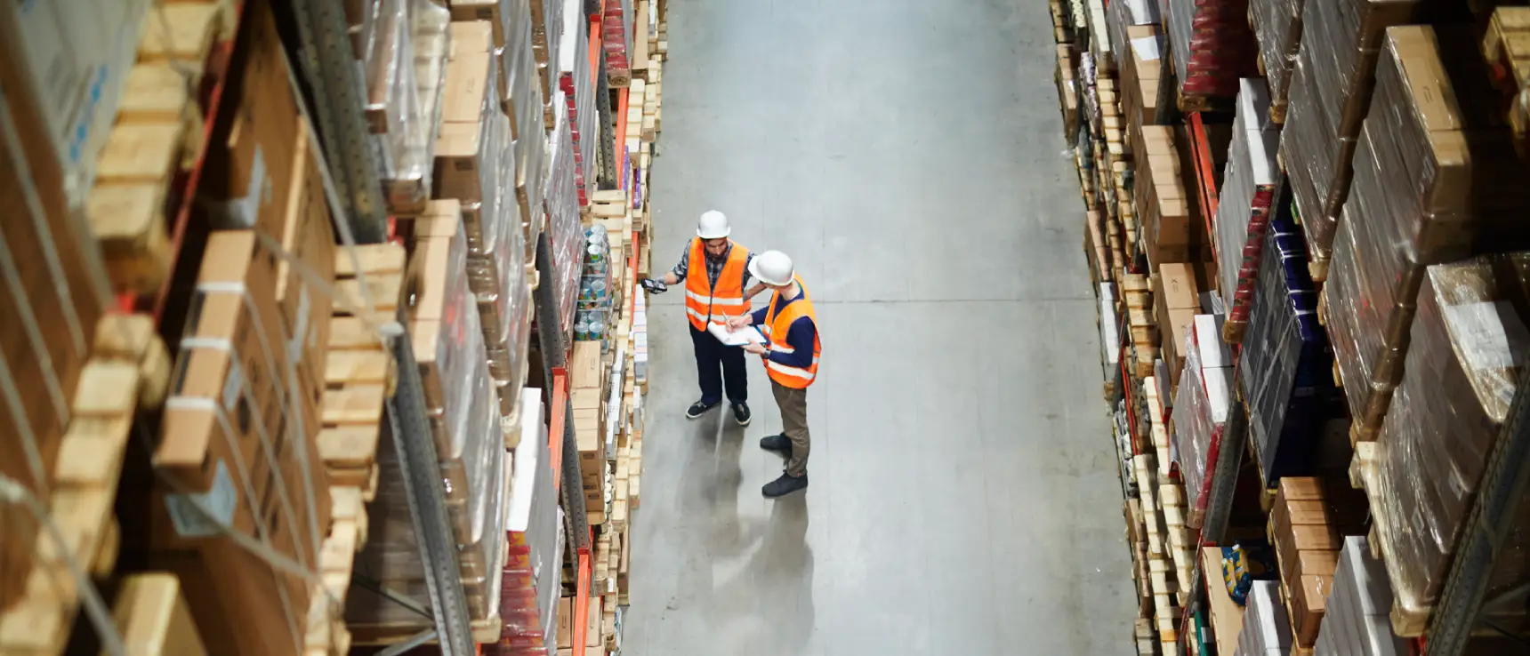
Drone-as-a-service is a user-friendly solution to streamline warehouse inventory. It helps warehouses promptly handle inventories without extra time or money investment – read our previous post to learn more. Today, we will dive deep into solution functionality, what it can and can’t do.
Myths about drones and warehouses
Myth #1. Tricky when open
“Is it possible to count the exact number of boxes/products in an open pallet with this solution?”
That depends on the type of your pallet: a full or a mixed one. A full pallet is a completely sealed package with a certain amount of products inside and a barcode and other product information stuck outside.
Our drone-based solution is better at counting full pallets, as it scans the code from the sticker and sends the information to the server. Now, we need to know the number of boxes in one sealed pallet to easily calculate the total on the rack and at the warehouse.
It is not uncommon that somebody opens these pallets to pick up and deliver a few products to customers, which turns full pallets into mixed ones. Technically, our solution can scan the barcodes on such pallets and take a picture of a mixed pallet on the shelf, but it will be difficult to determine the exact number of whatever is inside. Products might be taken from the middle of the pallet (the rest forms something like a “well”) or from the side, which – should the pallet be turned – will face a wall and remain undetected at the time of inventory.
Here is what we can offer: a drone will both scan pallets and take pictures to report on each pallet in a warehouse. Each picture will be linked to the scanned barcode in the report. In addition, pallets can be labelled as mixed or full, so if there are a few mixed ones, the products inside can be counted manually or using a picture taken earlier.
Myth #2. Wrong stickers
“What if our employee puts a sticker on a pallet with the wrong barcode? Would you be able to fix it during warehouse demo?”
A drone is sadly unable to make it right. Perhaps a day might come when we can fully rely on machine intelligence and the drone’s commitment to a company, but not today. Currently, a drone only scans barcodes and records the pallet’s condition and location without carefully reflecting on what it is doing.
Myth #3. Any drone can take warehouse inventory
“Why do you use custom drones when there are plenty of common ones that you can easily make fly?”
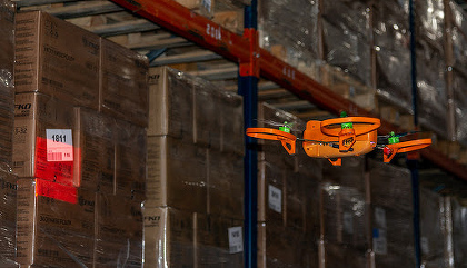
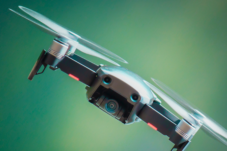
It’s not that simple. In case of warehouse inventory, a standard drone, which can be piloted by almost anyone, is unlikely to take stock indoors, because such a drone is using GPS. It is challenging for signals from a satellite to pass through metal structures and thick walls of a warehouse, so a standard drone will be less than useless.
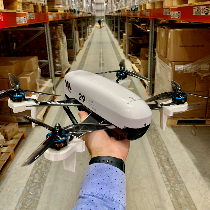
We use a custom drone with a built-in navigation system to dodge between racks without help from the GPS. Our experienced pilot can skillfully navigate the drone, which is yet another booster that helps complete the job fast.
Why warehouse demo matters
A demo at a warehouse is an efficient way to bury myths and see solution benefits in a real-life situation. After all, like I said, a product is created to solve a specific problem, and a demo will help you understand whether this solution makes sense to your business.
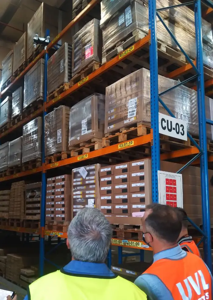
Our team has given demos for eight major warehouses in the UAE so far, including Abu Dhabi Ports. The demo includes the following:
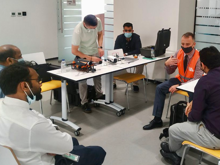
- A brief presentation to describe essential points of the solution and its main advantages (fast stocktaking, cost-efficiency, no heavy equipment involved, no warehouse downtime, etc. – my previous post covers everything in detail).
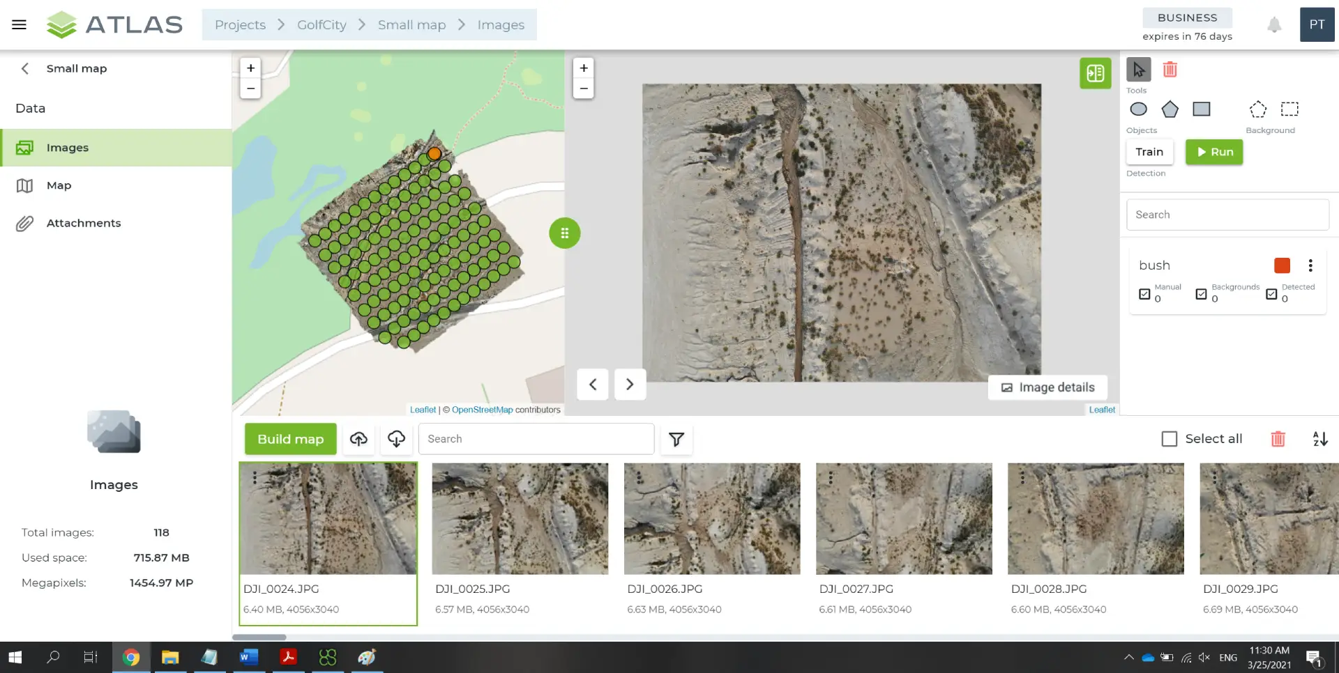
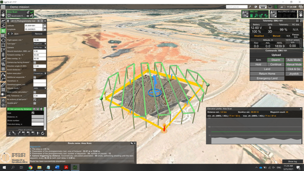
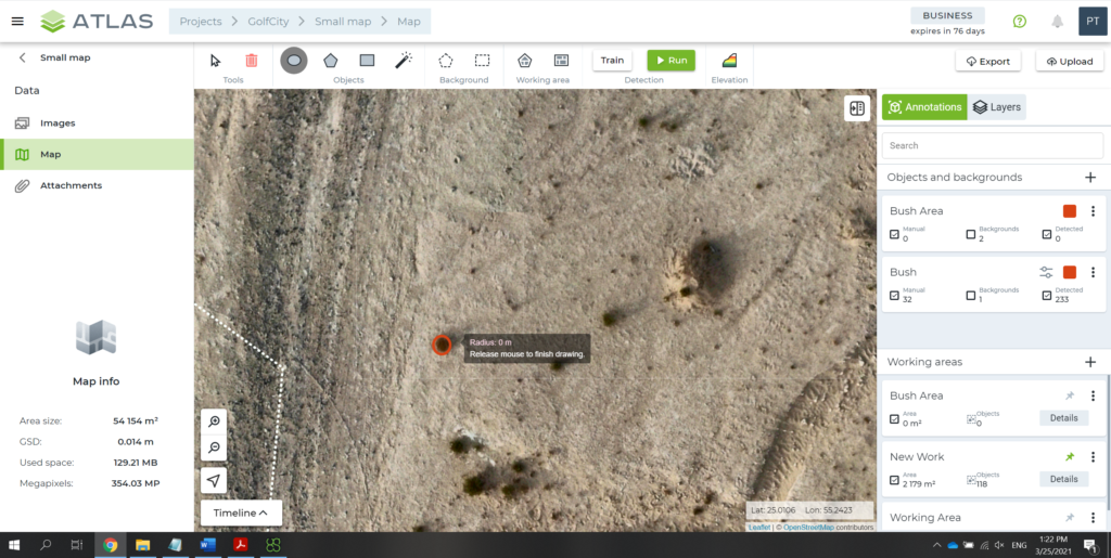
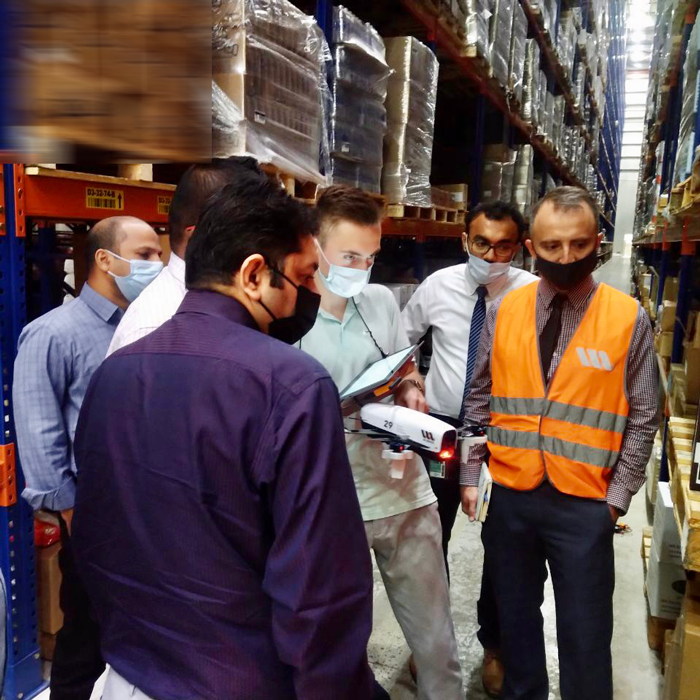
- Moving on, a pilot has an assembled drone ready to demonstrate how the solution works. The drone flies between the racks and scans the pallets. A tablet allows you to watch and control scanning, as the scanned areas are highlighted on a warehouse model.
- When information is collected, we export the report in an Excel file for you to review and study it carefully.
- Finally, there is a Q&A session and a small amusement. Anyone can try on our pilot’s VR headset and enjoy the first-person view of the flying and scanning process.
We’ll be happy to give you a warehouse demo. Just answer a few organizational questions (to let us know the type of your warehouse) and choose a day convenient for a demo. No additional documentation is required. We are always ready to go.